Drones
Read our onepagers (in Danish) for more on traffic measures using drones.
You are welcome to contact Hermes Traffic Intelligence to learn more about our drone based solutions.
Using drones for traffic measurements
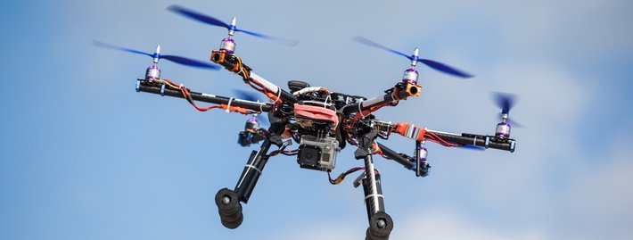
Using drones to capture footage of traffic as seen from above has its adventages. First of all it is easier to put up a drone for a limited time period than it is install e.g. cameras in poles at an intersection. And with a drone it is possible to go both higher, to cover a larger area, and to move the camera around to find the most suitable place to film.
We have developed algorithms for analysing drone imagery from different scenarios. If you wish to obtain knowledge about traffic for a given stretch this requires a specific set of functionality, while area based knowledge requires a different set.
Traffic counts
To get more knowledge about a stretch of road, e.g. the distribution of speed or car density, we need to have the drone fly over the stretch, preferably having small standstills at predefined locations.

BPR function calibration
In traffic modelling, the BPR formula is commonly used to express the relationship between travel time and traffic flow. It is therefore crucial to have high quality and up-to-date knowledge of the parameters that define the BPR function if one is to have an accurate traffic assignment model. Drones can be used to provide the actual impact of traffic on travel time since they are able to perform both traffic count and speed measurements in the same time. In this way, the values for the parameters of the formula reflect the actual traffic resistance of the stretch, and there is no longer the need to use pre-defined, or assumed values. Using the observed Travel Time Tf (minutes) and the observed Traffic Volume V (vehicles per hour) as they are gathered by the drone, the α and β parameters can be accurately modelled and estimated.
Information about areas
To get proper information about an area it might be necessary to set up more than one drone. By stitching the images delivered by a number of drones it will be possible to cover a larger area. Analysing the larger cover can e.g. provide O/D matrices.
Hermes Traffic Intelligence
Diplomvej 381
DK-2800 Kongens Lyngby
Denmark
Contact: info@hermestraffic.com
© Hermes Traffic Intelligence,
all rights reserved